


- FS17
- 07
- 12.2017
- 13:32
FS17 Bloniec
|
|
Gallery


Description
FS17 Bloniec
The map presents the village of Błoniec as the main and adjacent Szczaworyż and Żerniki Górne, near Busko Zdrój. Some elements of the infrastructure landscape date back 30 years and now do not exist, but I have placed them to give the climate of the village of those times. The rest of the area is not real. The distribution of roads, forests, fields, buildings has been faithfully given as much as possible, the models of objects come from different maps to make them look a bit like real ones. Density of vegetation and trees may burden the weaker comps, then I recommend to remove the appropriate amount in the map editor. There is no traffic and railway traffic, there are all typical crops, many farms, 2 sawmills, BGZ, purchased fields. The map is in three files to be downloaded due to the whole weight
http://www54.zippyshare.com/v/AzwPFFUy/file.html
http://www54.zippyshare.com/v/zcuWhSVu/file.html
http://www54.zippyshare.com/v/f15cexPa/file.html
I have personally created the map personally using objects, buildings and triggers from various other existing maps, so if someone recognizes an element, the object of your authorship is thank you in advance and I apologize but I built the map so that everyone can have a good time at a real farmer and at to get to know the area where I spent my holidays.
Although I have a bit of sweat, there are no prohibitions for editing, I wish you a lot of fun.
Credits
ZOLTAR
Similar FS17 Maps and Objects mods

Polska Wioska

XLFarms Projects X2 – Final Compilation Part 1 v12.2.1

Buscot Park Farm v1.0.1

National park of the dutch biesbosh

The Old Farm Countryside v1.0.6.6

Mustang Valley Ranch v3

Drumard Farm

Nordfriesische Marsch v1.3


nie pobierać szkoda czasu pliki są zepsute i nie da się otworzyć pozdrawiam
Witam w nowym roku, myślę, że kolega już opanował sztukę rozpakowywania wieloczęściowego archiwum. Poniżej podaję link do patcha v1.2, dodałem drugi silos do bazy PGR-u i kilka kosmetycznych korekt w kilku miejscach. Na kilku polach, które są dostępne bez kupowania a graniczą miedzą z polami kupowanymi występuje na dosłownie 2-3 metrach na 1 metr odcinkach kolizja, że pole nie należy do gracza z uwagi na wąskie miedze, komunikat znika gdy się kupi sąsiednie pole. Plik należy pobrać, rozpakować i przekopiować zawartość do pliku z grą w miejsce starych potwierdzając zamianę, chyba każdy da sobie z tym radę.
Link:
http://www5.zippyshare.com/v/6RksGosf/file.html
Wszystkie silosy, skupy, tartaki biogazy, wodociągi(nie przy każdym hydrancie są) i wrota działają. Na końcu jednej drogi doszło do powodzi, nie wjeżdżać bo się pojazd utopi :)
To już ostatni patch, wszystko jest tam gdzie ma być a jak ktoś woli coś przestawić lub dodać to dzieła, zostawiłem trochę wolnego miejsca na majsterkowanie.
Wszystko działa tylko gdzie tu się zborze do silosu/binu sypie ?
Witam, jeden zsyp do silosu znajduje się w stodole, na wprost do careerStartPoint , trzeba tam wjechać, przed stodołą jest helpicon, drugi znajduje się na terenie gospodarstwa we wsi na północnym krańcu, jest na zewnątrz, oznaczony markerami, oba zsypują do tego samego silosu. Wysyp ze silosu znajduje się jedno gospodarstwo na lewo od careerStartPoint za stodołą, tam się hoduje świnie i krowy. W gospodarstwie za płotem po prawej hoduje się owce, kury chodzą po dwóch gospodarstwach. Zanieczyszczenia po zwierzętach gromadzą się na tym gospodarstwie po prawej na tyłach obory przy kupie gnoju, ze wszystkich trzech gatunków, łatwiej i szybciej się sprząta. Pliki są spakowane 7zipem i rozpakowanie zaczynamy od pliku nr 1 reszta się automatycznie rozpakuje do całości. W sklepie jest dwoje wrót, podnosiły się do góry ale po patchu 1.5 przestały albo jakiś mod się nakłada z obłożeniem klawisza “o” bo na taki się otwierały, inne wrota działają na LPM, zauważyłem to po wysłaniu plików. Można wrota ze sklepu schować pod grunt w edytorze bo wewnątrz znajduje się sellAreaTrigger gdzie można sprzedawać lub modyfikować pojazdy.
Witam, ja mam taki problem, ze jak wysypuje na przeciwko careerStartPoint to nie wsypuje mi się do silosu. W sensie nie pojawia się w silosie a z przyczepy znika.
Fakt, też to teraz zauważyłem, wcześniej wszystko sprzedawałem do skupu i nie gromadziłem w silosie, zbadam sprawę i niezwłocznie podam poprawki. Do tego czasu polecam sprzedawanie albo wysypywanie na kupę w dogodnym miejscu i proszę o cierpliwość, sam jestem ciekaw czemu się tak stało
UWAGA! patch do mapy v1.1.81
a tak na serio dobrnąłem do problemu, wysyp od zsypu nie może być za daleko, właściwy trigger był we wsi na północy mapy i dla tego się nie widziały, teraz zsyp do silosu jest w stodole przy silosie na tej samej gospodarce po lewej od starta. Wystarczy pobrać plik map01.i3d z linku i rozpakować zwykłym zipem i podmienić w pliku z głównym mapy. a w stodole na wprost można składować baliki słomy czy siana, jak kto woli
link:
http://www38.zippyshare.com/v/fFlmODtd/file.html
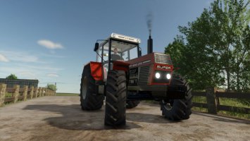
Jakby ktoś znalazł jakieś inne nieścisłości to podawać info bo sam mogłem czegoś nie zauważyć, dopiero rozpocząłem karierę i będę testował każde gospodarstwo po kolei. Pięknie tu pasują stare C330 tki, c360, Władimirce, takie po tej wsi szalały i nadal szaleją :) oraz wiele pradawnego sprzętu rodem z PRLu
Jakbyś dał jakiś namiar na siebie to będę podsyłał różne błędy wraz ze screenami to będzie łatwiej może. A przegrane na tej mapie już mam ze 50h. A moja 60-tka to już ma 21mth nabite. Tak mi spasował klimat i sama mapa, chociaż nie ukrywajmy kilka błędów i niedociągnięć jest :)
Siema, cieszę się, że trafiłem w gust paru innym graczom, map z nowoczesnymi gospodarstwami jest bez liku, z małymi też ale wiele z tych małych obszarowo dużo miejsca nie obejmuje, więc przeniosłem z reala wioski dopasowując do możliwości edytora ale żeby oddać trochę tego klimatu. Najwięcej elementów zawiera główna wieś. Krótkie opisy problemów proponuję tu wstawiać, wtedy jak ktoś inny natrafi na ten sam to już nie będzie potrzeby powtarzania a ewentualne poprawki lub odpowiedzi będą też dla wszystkich dostępne. 3 – 4 drogi, prowadzą do wolnej przestrzeni pod edycję i służą jako wizerunkowe odnogi, jakby ktoś miał pomysł co tam umieścić, zakazów edytowania nie ma.
Jeśli chodzi o animacje czy programowanie triggerów to jestem laikiem i korzystałem z już istniejących, tu może pomóc ktoś bardziej zaawansowany w tworzeniu efektów.
Podaj lokalizację w stylu gospodarstwo w[95,100] pozycja na mapie wyświetlana w prawym dolnym rogu i problem. Jeśli będzie to się dało poprawić to podam link do poprania pliku
Tu podaję link do samego pliku map01.i3d gdzie te niedziałające wrota są ukryte, wystarczy plik rozpakować i przekopiować do pliku całej mapy w miejsce starego map01 w katalogu Bloniec.zip\maps\
http://www120.zippyshare.com/v/9P1LGczI/file.html
plik zajmuje 500k
To dla tych co nie mają zainstalowanego GiantsEditora
Pobrałem mapę z tych linków, wszystkie 3 muszą być pobrane i umieszczone w jednym katalogu zanim zaczniecie rozpakowywać jak opisałem wyżej i wszystko działa
Archiwizator – 7z, jest darmowy
Z tego linku już nie pobierać, powyżej jest najaktualniejsza poprawka v1.1.81
Czyli na tej gospodarce po lewej od startpoint-u, nie ma zsypu tylko wysyp, tak? Dobrze zrozumiałem?
Tak, umiejscowienie świń i krów na tym gospodarstwie, tj obszar po którym biegały występował w realu, dlatego wysyp tam umieściłem aby świniom wygodniej było podawać zboże, Wiadomo koryta z gry nie są odpowiednikiem realnych. Na wsi Błoniec w marę realnie rozmieściłem budynki, płoty, sady, pola itp, Wygląd budynków na ile to było możliwe dobrać z istniejących. Niektórych już realnie nie ma bo zostały wyburzone ale sentymentalnie je umieściłem, taki misz masz z ostatnich 30 lat. Na GoogleEarth można zwiedzić wieś, akurat goglowóz tam się przejechał :) Na tych trzech gospodarkach rozłożyłem te główne elementy. Paliwo można zatankować, na 2-gim gospodarstwie idąc w lewo do końca wsi i przy sklepie z tyłu garażu gdzie stoją stoją beczki, poza tym na stacji paliwowej. Wioska przystosowana do małych sprzętów, dla cięższego sprzętu jest baza na zachodzie mapy między tartakiem a BGA. Jest jeszcze poniżej pusta baza na umieszczanie kupowanych zabudowań
Ok, dzięki wielkie, mapa super. Pozdrawiam :)